News
Dhaka's Duplicate Image Problem: How the City Stacks Up Against Mumbai and Nairobi
Urban databases across Dhaka are clogged with redundant digital imagery — and the city's clean-up effort is only just beginning.
4 min read
Updated 4 h ago
News
Urban databases across Dhaka are clogged with redundant digital imagery — and the city's clean-up effort is only just beginning.
4 min read
Updated 4 h ago

Dhaka City Corporation's digital mapping division quietly acknowledged earlier this year that a significant share of the georeferenced imagery stored across its land-use and infrastructure databases contained duplicate or near-duplicate files, inflating storage costs and slowing down planning workflows. The acknowledgment came during a February 2026 internal audit review, and its implications are now rippling through several municipal departments that depend on clean visual data to manage a city of roughly 22 million people.
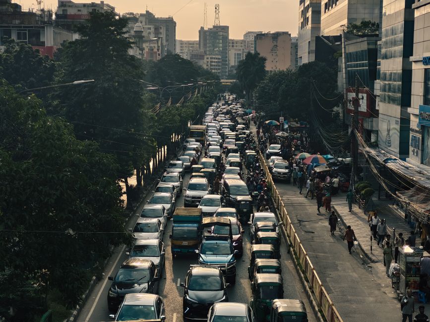
The issue matters right now because Dhaka is deep into a multi-year push to digitise its urban management systems — from water pipe mapping in Mirpur to building permit records in Motijheel. When duplicate images clog a dataset, planners pulling aerial scans or street-level survey photos can make decisions based on outdated or redundant frames. That is not a minor inconvenience in a city adding hundreds of thousands of new residents each year and issuing thousands of building permits annually.
The Rajdhani Unnayan Kartripakkha, better known as RAJUK, has been working since late 2025 with local technology firm DataVerse Bangladesh — headquartered in the Karwan Bazar tech cluster — to run automated deduplication scripts across its satellite and drone image archive. The archive, built up incrementally since the Smart Dhaka Initiative launched in 2019, had grown to hold imagery covering the entire capital, but with no systematic process for flagging files captured on overlapping flight paths.
Dhaka South City Corporation has taken a slightly different approach. Its GIS unit, based out of Nagar Bhaban on Fulbaria Road, has been piloting a hash-based image comparison tool since March 2026, comparing each uploaded file against a reference index before it enters the live database. The tool flags near-duplicates for human review rather than deleting them automatically — a more cautious method that preserves contested boundary imagery for later verification.
Neither approach is yet standardised across all city agencies, and coordination between the two city corporations — north and south — on data protocols remains inconsistent, according to publicly available meeting minutes from the Urban Resilience Project steering committee published in May 2026.
Mumbai's Brihanmumbai Municipal Corporation began a city-wide image deduplication program in 2023 under its GIS Modernisation Project, reducing its urban imagery archive size by an estimated 34 percent within 18 months, according to figures the BMC published in its 2024-25 annual report. That effort benefited from a centralised data warehouse — something Dhaka's fragmented municipal structure makes harder to replicate quickly.
Nairobi presents a more instructive parallel. The Nairobi City County government faced a similar fragmentation problem as recently as 2022, when its planning directorate discovered that drone surveys of informal settlements in Mathare and Kibera had generated overlapping datasets held by at least four separate departments. The Kenyan capital resolved the issue partly by contracting a single data aggregator under a 2023 framework agreement — a model that some RAJUK officials have pointed to in internal discussions, though no equivalent contract has been publicly tendered in Dhaka as of July 2026.
What sets Dhaka apart from both cities is the sheer velocity of data generation. The city's ongoing infrastructure programme — including the Dhaka Metro Rail expansion toward Gazipur and new feeder roads through Demra — means new survey imagery is being produced faster than existing archives can be cleaned. DataVerse Bangladesh has indicated publicly that deduplication tools need to be integrated at the point of capture, not applied retrospectively, if the backlog is not to grow further.
For city residents and developers, the practical consequence is simpler than it sounds: building permit applications that rely on site imagery submitted to RAJUK can be delayed if the document management system flags a submitted photo as a potential duplicate of an earlier submission from the same plot. Applicants dealing with this at the Motijheel office have been advised by RAJUK staff to submit images with embedded GPS metadata and a timestamp visible in the frame, which helps the automated system distinguish new captures from recycled files. Until a city-wide deduplication standard is in place, that workaround is likely the most reliable route for anyone pushing a planning application through the system.
News
News

News
News
About this article
Published by The Daily Dhaka
Spread the word
Daily brief
Free, in your inbox before 7am. Weekdays.